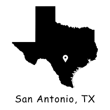
Urban Expansion and Land Use Classification: A Case Study of San Antonio, Bexar County, Texas
INTRODUCTION
Why This Study Matters:
• As rapid urbanization continues to increase, this study identifies the impacts on ecosystems and planning.
• Helps policymakers in urban planning and environmental conservation.
• Understand population pattern growth pattern across the Bexar county.
Key Focus:
• Identify and quantify urban expansion particularly as urban expansion affects agricultural ecosystems.
• Provide baseline data for sustainable development initiatives.
PROBLEM STATEMENT
Urban sprawl in Bexar County has led to significant land cover changes over time, including the conversion of agricultural land into urban areas. However, there is limited understanding of the extent, patterns, and dynamics of these changes. This study seeks to address this gap by using remote sensing techniques to analyze land cover changes from 2008 to 2022 and quantify the impact of urban expansion on agricultural ecosystems, providing essential insights for sustainable land-use planning.
OBJECTIVES
• To understand the extent of urban sprawl in Bexar County using remote sensing techniques.
• Analyze Land cover changes from 2008 to 2022
• To analyze how urban expansion encroaches upon agricultural land in Bexar County, quantifying the extent and patterns of land conversion over time.
STUDY AREA
• Bexar County located in South Texas
• Created on December 20, 1836
• Estimated Population (US Census Bureau 2024): 2,115,167
• Texas’ most populous majority-Hispanic county and the third-largest such nationwide
• Total area: 1,256 square miles (3,250 km2)
• County seat is San Antonio.
DATA AND METHODS
Data Sources:
• Aerial imagery (Ortho Imagery – Ortho NAIP) from the United States Department of Agriculture.
Methodology:
• Image classification using supervised algorithms – Maximum Likelihood.
• Accuracy assessment and validation using 100 reference points for each year.
• Mapping and spatial analysis in ArcGIS Pro.
RESULTS AND ANALYSIS
Findings:
• Urban areas identified and quantified over a period (2008 – 2022).
• Key trends in urban sprawl patterns highlighted.
Visualization:
• Maps showing classified land use (urban, vegetation, water, etc.).
• Maps showing Urban expansion in the county over a period.


CHALLENGES
Challenges Encountered:
• Cloud cover and data quality issues in Satellite imagery.
• Processing high-quality data requires high-performance computing resources.
• Balancing classification accuracy with computational efficiency.
Future Improvements:
• Refining classification algorithms for better results.
• Performing more detailed analysis such as Hot Spots Analysis
CONCLUSION
Summary:
• The study provides a comprehensive analysis of urban sprawl in San Antonio, Bexar County.
• Highlights the importance of spatial analysis in urban planning to understand the effect on agricultural lands.
Implications:
• Data-driven recommendations for sustainable development.
• Supports decision-making for urban and environmental policies.